
(A 13km Walk Through History, Forest Paths, and… One Tower Mansion)
Reading time:
About 5 minutes — just right while waiting for your cup noodles to soften.
Who This Walk Is For
- People a little tired of the crowds at the famous Mt. Takao
- Those who love quiet, slightly nerdy, lesser-known places
- Anyone who wants a budget-friendly weekend hike
- Folks who don’t want to go far, but still want to zone out with a great view
Conclusion (Short Version)
Right next to a quiet residential area in Yokohama, there’s a place where Japan’s mapmaking history began — and where a peaceful forest corridor still survives.
At just 100 meters high, don’t underestimate it.
This route delivers history, scenery, and the kind of fatigue that actually feels good.Welcome to the not-Tokyo Mt. Takao.
“I Went to Mt. Takao This Weekend.”

Say that, and 100 out of 100 people will picture the famous mountain in Hachioji — cable cars, dumplings, and crowds.
But that’s not where I went.
I went to Mt. Takao in Yokohama.
It’s in Midori Ward, Yokohama City.
Elevation? About 100 meters.
(100.46m if you want to be precise.)
You might think:
“That’s… low.” 😅
I thought so too.
But after walking it, I realized this wasn’t just a stroll —
it turned into a surprisingly rich little journey.
Today, I’ll walk you through the 13km traverse from Tōkaichiba Station to Suzukakedai Station,
along with updates from my middle-aged lower back (important).
Route & Stats (From My Activity Log)
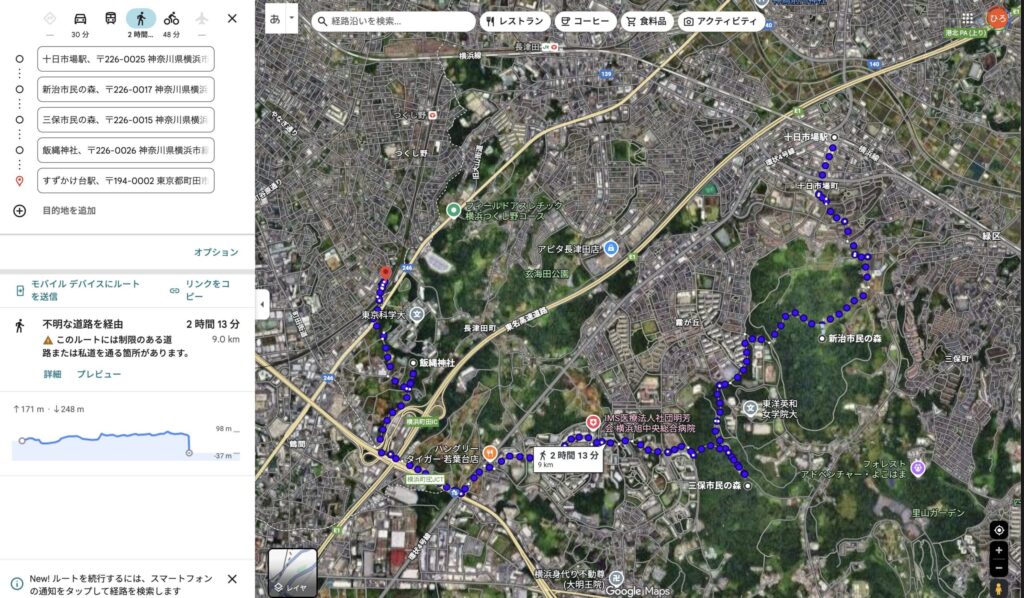
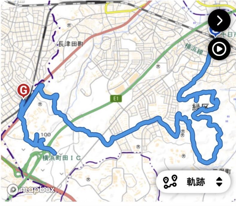
🗺 About the Route Google Maps makes it look like a single path, but I actually explored all over the forest, as shown in the tracking log. The map shows the “shortest route” (approx. 10km), but with fun detours, it becomes a satisfying 13km hike with over 400m of elevation gain!
Route:
JR Tōkaichiba Station
→ Niiharu Citizen’s Forest
→ Miho Citizen’s Forest
→ Mt. Takao (Iizuna Shrine)
→ Tokyu Suzukakedai Station
- Distance: approx. 13.0 km
- Time: 3 hours 23 minutes (including breaks)
- Total ascent: 412 meters
“Wait — how do you climb over 400 meters on a 100-meter mountain?”
Good question. I said the same thing.
This route constantly dips and rises through yato terrain — small valleys and ridges —
so the elevation gain stacks up fast.
In total, you climb more than Tokyo Tower’s height under your own power.
Lesson learned:
Don’t underestimate low mountains. My back didn’t.
Course Breakdown: From Satoyama to Sacred Ground
Start → Niiharu Citizen’s Forest
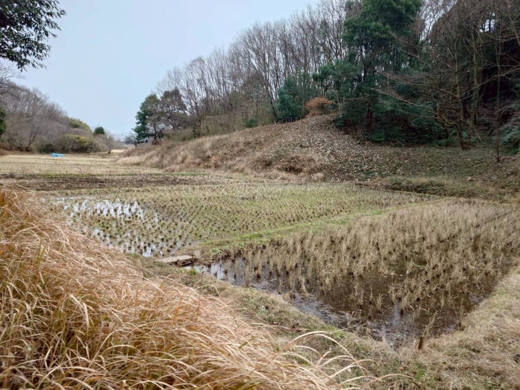
Leave Tōkaichiba Station, walk a bit, and suddenly you’re inside the forest.
And your brain goes:
“Wait… this is still Yokohama?”
Dirt paths, thick trees, wetlands —
a preserved satoyama landscape that feels untouched.
It’s not over-manicured, and that’s the charm.
Just breathing the air here already feels like a win.
The Forest Relay: Niiharu → Miho

After Niiharu, a short stretch of road leads into Miho Citizen’s Forest.
This is one of the best parts of the route:
green spaces connected like stepping stones.
Miho’s ridge trail is especially pleasant.
You expect to pass other hikers and exchange greetings…
But I didn’t see a single soul.
For a moment I wondered:
“Am I… sealed inside a barrier?” 😆
The Summit: Mt. Takao & Iizuna Shrine
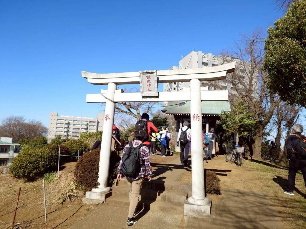
After a steeper climb and some stairs, you reach the highlight —
Iizuna Shrine at the summit.
Here’s where a long-held mystery clicked for me:
Why is there a Mt. Takao in Yokohama?
Turns out, this shrine was officially enshrined from Mt. Takao in Hachioji —
sharing the same deity, Iizuna Gongen.
So this isn’t a copy.
It’s a legitimate branch — a proper “norenn-wake.”
And there’s more.
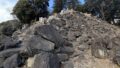
This spot also hosted a first-class triangulation point in the Meiji era.
Before GPS existed, Japan’s national maps were measured from here.
Standing there, I thought:
“So this is where Japan was measured.”
That realization gives the small shrine a surprisingly heavy presence.
A Perfect View… With One Small Complaint
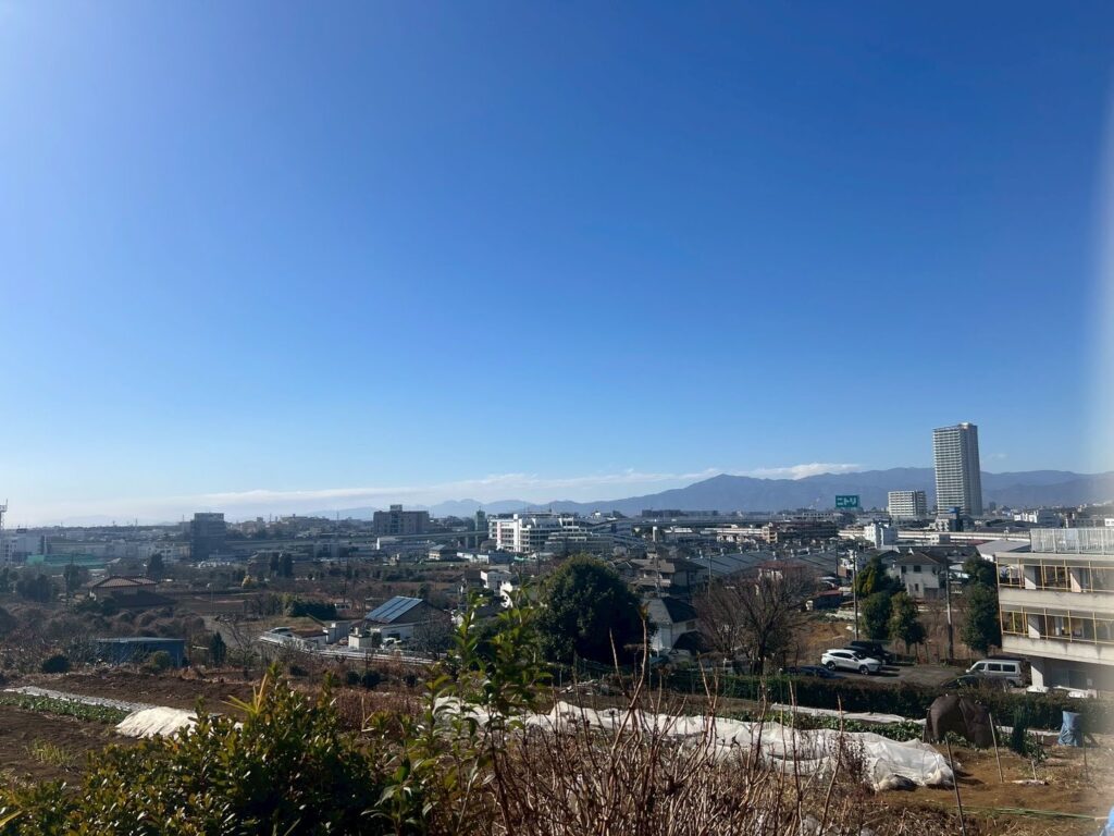
From the summit, the view opens wide.
The entire Tanzawa mountain range spreads across the horizon.
Fields below, city beyond.
(Seeing a Nitori sign adds a weirdly comforting touch of daily life.)
But let me be honest.
That one tower mansion… yeah, it’s kind of in the way. 😂
Still, the more I stared, the more it felt right.
Nature.
City.
Mountains.
A single high-rise.
This mix is also part of modern Japan’s scenery.
Sit on the bench, eat an onigiri, crack a beer…
Yeah, that would’ve been perfect.
Finish Line: Suzukakedai Station
After soaking in the view, it’s downhill.
Through the shrine approach, across Route 246, and you’re at Suzukakedai Station.
After 13km, the asphalt hits your legs hard —
but the sense of completion is solid.
The Real Finish Line
Let’s be honest.
All the history and scenery aside,
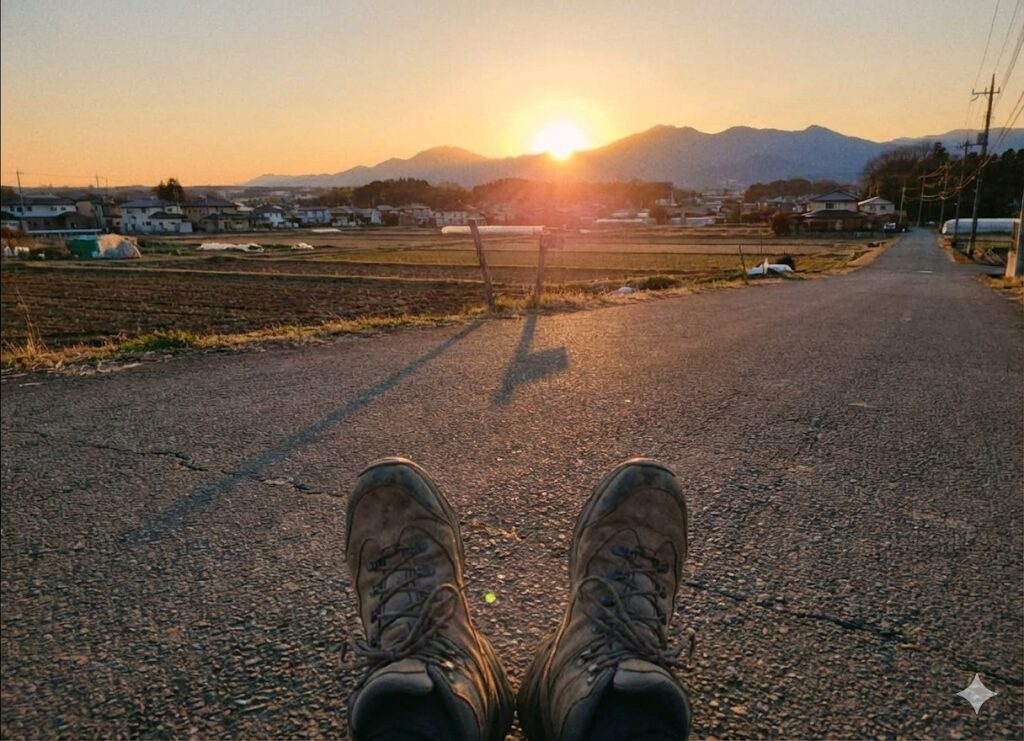
my true goal was this: a cold beer after the hike.
Clinking glasses at the station with my walking buddies,
I swear I heard my cells whisper:
“We’ve been waiting for this.”
After 13km,
beer beats any luxury wine.
A Few Words From a Middle-Aged Hiker
Learned the hard way, so you don’t have to:
- Wear proper shoes
This is not a park stroll. Dirt, roots, mud — sneakers at minimum. - Use a hiking map app
Google Maps can struggle in the forest.
Apps like YAMAP handle the Niiharu–Miho–Takao routes well. - Plan toilets & snacks
Toilets exist, but no shops inside the forests.
Buy water and snacks near the station first.
And yes — it’s still the city. You can’t just “handle it anywhere.” 😅
Final Thoughts
Waiting in line at famous tourist spots can be fun.
But a quiet weekend spent walking through local history,
surrounded by forests, and ending with sore legs and great beer?
That’s a pretty good day too.
If your weekend is free,
how about the “Mt. Takao” of Kanagawa?
I’ll see you in the next post —
once the muscle pain fades.
(The next day, my back disagreed. Still worth it.)
You might also enjoy this article
Mt. Takao’s Hidden Trail – A Quiet Escape Few Ever Find
After walking Yokohama’s Mt. Takao, this story lets you compare it with the “real” one near Tokyo—quiet, calm, and deeply refreshing.A Surprisingly Quiet Sunday at Year-End — A No-Regret Walking Guide to Machida Yakushiike Park
Perfect for those who want nature without crowds. A gentle walk close to the city that pairs beautifully with Yokohama’s hidden Mt. Takao.🍁 Kanagawa, Japan — A Perfect Easy Hike for Beginners: My Relaxed 50s Getaway to Mt. Zukkō
Low elevation doesn’t always mean easy. A relaxed but insightful hike that works perfectly as a follow-up to Yokohama’s Mt. Takao.

コメント